NSW Seismic Survey Opens New Critical Minerals Targets Across the Lachlan Fold Belt
New seismic and petrophysical data from the Lachlan Fold Belt has given explorers a deeper technical view of one of Australia’s most prospective copper, gold and critical minerals provinces. The NSW release combines crustal-scale imaging, rock-property datasets and open-access mapping to lower exploration risk across the Macquarie Arc and Cobar Basin.
New South Wales has released one of its most technically useful exploration datasets in years, giving miners and explorers a deeper view of the Lachlan Fold Belt at a time when copper, gold and critical minerals targeting is being reshaped by better precompetitive geoscience.
The new data package centres on a deep crustal seismic survey across the Central Lachlan region, supported by a newly released petrophysical dataset built from more than 1,200 rock samples.
Together, the releases give explorers a clearer framework for interpreting the architecture of the Macquarie Arc, Cobar Basin and wider Lachlan Orogen, where mineral systems are often controlled by deep structures that cannot be understood properly from surface mapping alone.
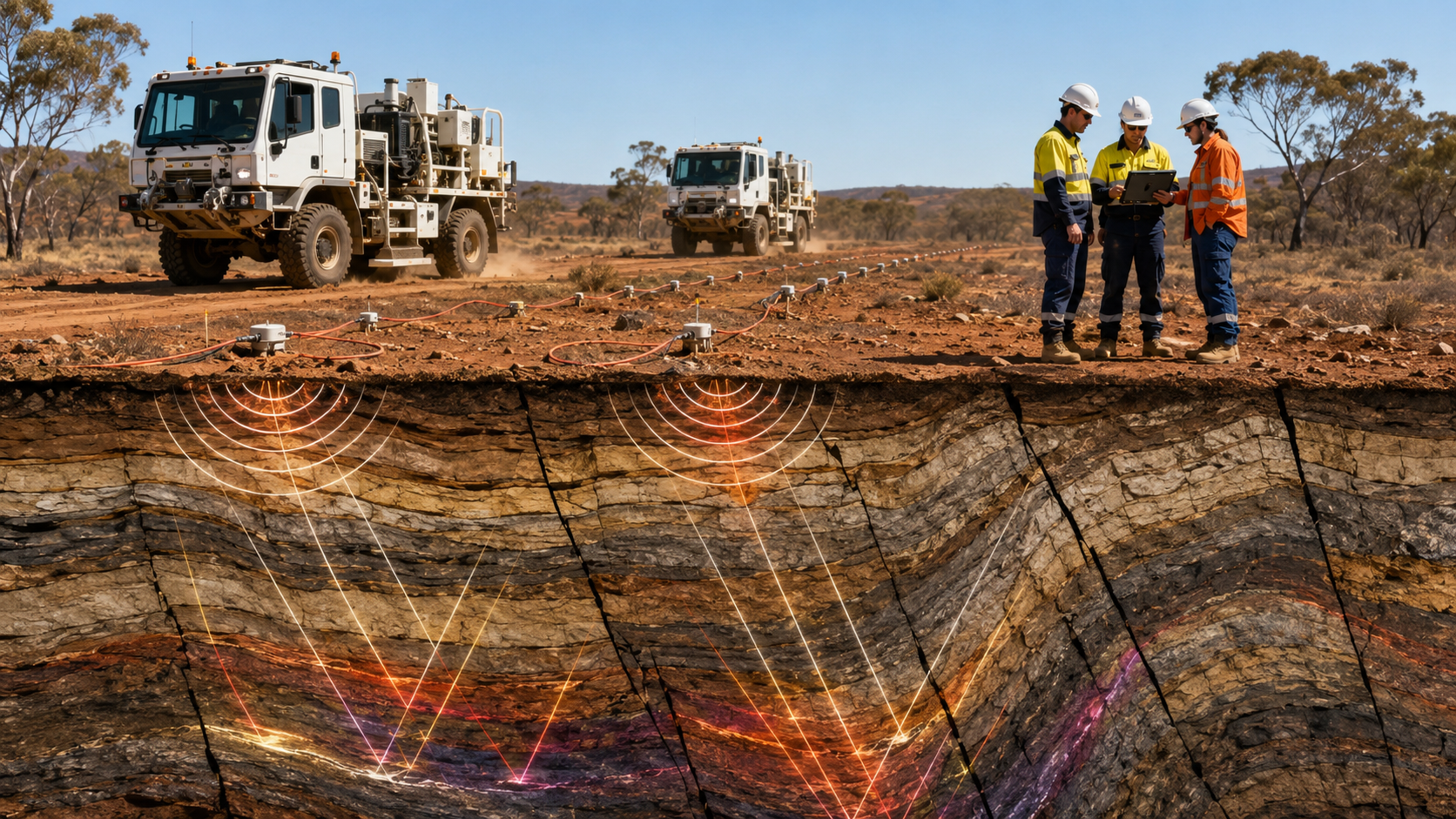
The technical core is the Central Lachlan seismic survey. The Geological Survey of NSW says 423km of deep crustal seismic data has been acquired and processed, imaging the Earth’s crust to depths of about 40km to 60km. The survey was designed to traverse the Macquarie Arc and improve understanding of the complex geological structure of one of the state’s most prospective mineral regions.
The survey includes two major lines. Line 1 extends the 2008 Rankin Springs survey from Euabalong across to Bathurst, creating a single deep transect of more than 400km. Line 2 builds on the 2023 Cobar-Yathong survey by extending CY1 out to 320km. For exploration teams, that continuity matters because it allows structural interpretation across a broader crustal section rather than forcing companies to work from isolated datasets.
Early interpretation points to a potentially important exploration outcome: rock formations known to host copper and gold may sit closer to surface than previously understood, while large fault systems linked to existing mining areas can be traced deeper underground. The release also identifies underground rocks associated with tin, tungsten and molybdenum, as well as rock types linked to scandium, nickel, cobalt and platinum.
The petrophysical atlas gives the seismic data greater value. More than 1,200 core samples have been assessed for magnetic, mass, seismic, electrical and natural gamma properties, with elemental composition measured using portable XRF. Each sample has been logged for lithology, weathering and mineralisation, then assigned to a stratigraphic unit with an indicative confidence level.
That gives geologists a stronger physical-property bridge between drill core, geophysics and 3D geological modelling.
The significance lies in how these datasets can change exploration risk. In mature mining provinces such as the Lachlan Fold Belt, easy surface discoveries are increasingly rare.
Modern targeting depends on understanding deep architecture, fluid pathways, fault corridors, intrusive centres and the physical signatures of host rocks. By releasing processed seismic data, petrophysical measurements and GIS-ready datasets through MinView, NSW is giving explorers a technical platform for ranking targets before committing to expensive drilling.
Precompetitive geoscience is not mine infrastructure in the conventional sense, but it functions as discovery infrastructure for the industry. The same way roads, power and ports lower development costs after a discovery, open geological datasets lower the cost and uncertainty of finding the next one. For smaller explorers, access to government-acquired seismic and rock-property data can materially improve target selection without requiring each company to fund large-scale geophysical programs independently.
The data release fits within the NSW Critical Minerals and High-Tech Metals Strategy 2024–35, which includes co-funded exploration support and royalty deferral mechanisms for new critical minerals projects moving toward production. The state is positioning its mineral systems data as part of a broader effort to attract exploration capital into stable Australian jurisdictions as supply chains for copper, battery metals, electronics metals and advanced manufacturing inputs become more strategically contested.